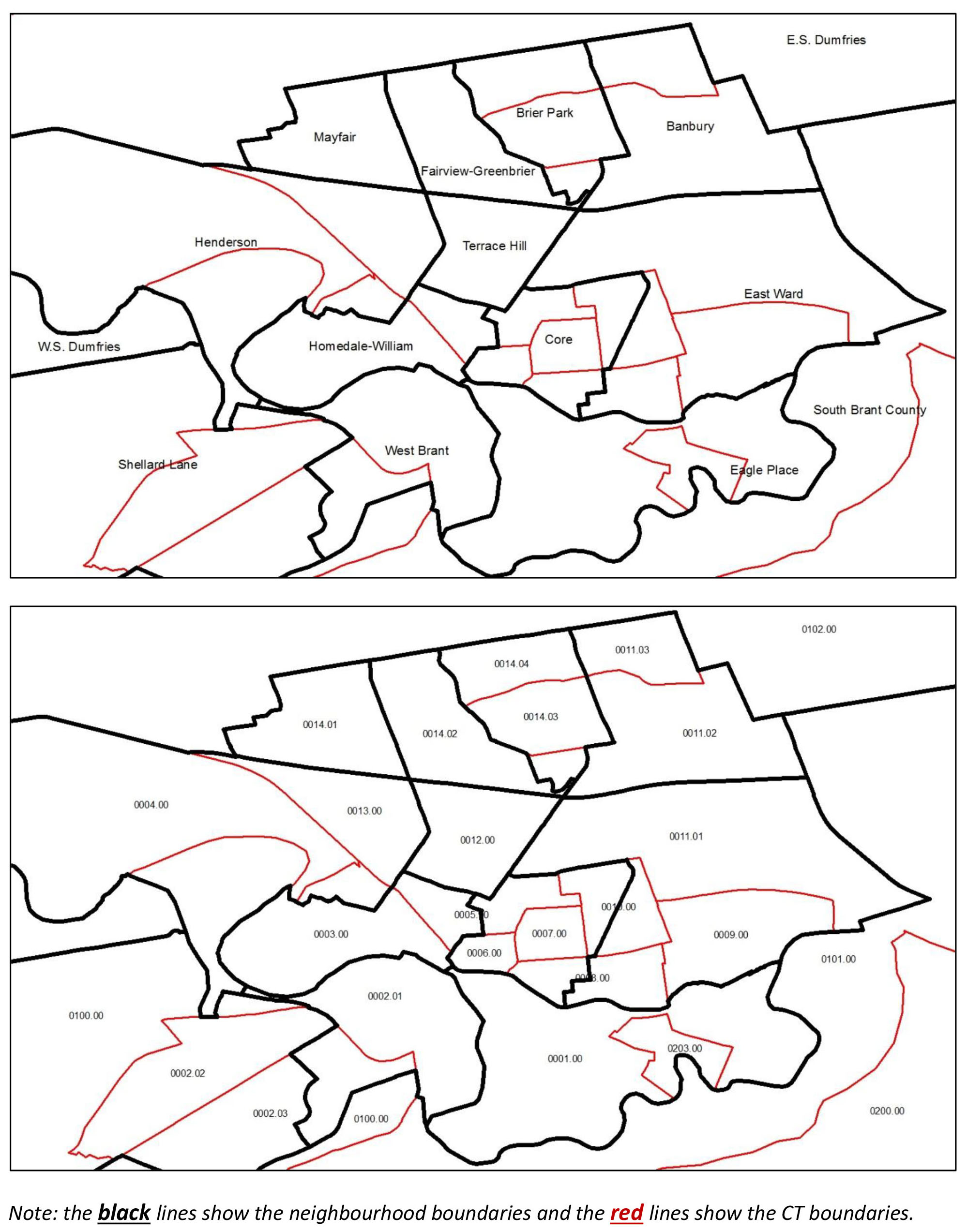
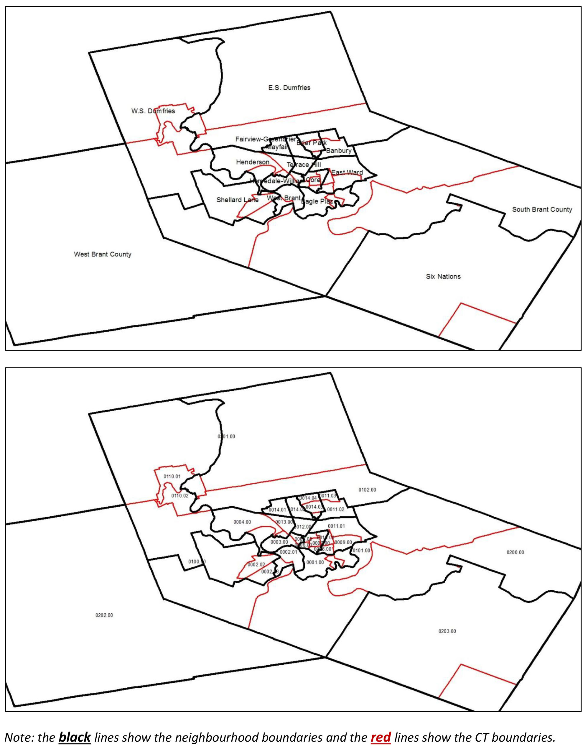
Brant Neighbourhoods and Census Tracts
Some statistics, particularly socio-demographics of Brant population, are presented in the Brant Health Atlas at the Census Tract (CT) level due to the original grouping of data available through the National Household Survey. CTs are relatively larger geographic areas than DAs and therefore their boundaries do not match, making it impossible to group the CT-level statistics into a neighborhood-level one.
On this page we provide the Brant County and the City of Brantford maps to demonstrate the relationship between the neighbourhood and CT boundaries.
Brant County Neighbourhoods and Census Tracts Boundaries
City of Brantford Neighbourhoods and Census Tracts Boundaries